
|
|
| Home Previous Next | |
|
|
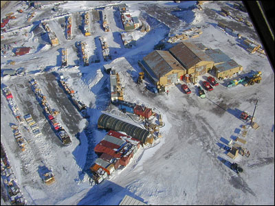
Travel on the ContinentTuesday, 7 November 2000I have been working out at Williams Field quite a lot lately. The Long Duration Balloon team is back again and we have been setting up their facilities. You will be hearing much more about their program as the season continues. They have many structures, both temporary and permanent. The permanent ones are still being dug out of the snow. 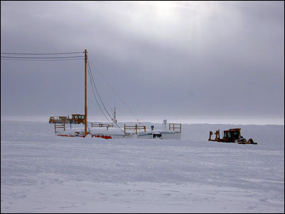
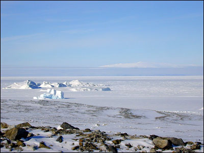
I love being out on the ice shelf. It is pleasant to get out of town and away from things. It is only about 7 miles out of town, but it makes all the difference in the world. They got the outhouses put in last week as there is no indoor plumbing anywhere out there. They just dig a big hole in the ice and put an outhouse over it. It is cold, but at least it is not out in the wind. However, when I first went in there the other day, it was covered with snow. Sitting on that was quite cold. 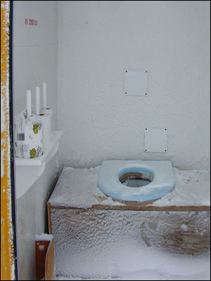
I also enjoy working there because I have some good friends who work on the balloon program. We have had quite a bit of varied weather. One day it is really cold, the next it is quite warm (well, warm for here anyway — around +14°F — you only need a warm sweater, certainly not your big parka). One day it is spectacularly beautiful, and then the wind kicks up and the clouds come in. The wind–chill was around –60°F one day and then +1°F the next. What I like best when we get weather like that is the patterns that begin to form in the snow and ice. Snow crystals begin to form on top of older snow. 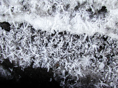
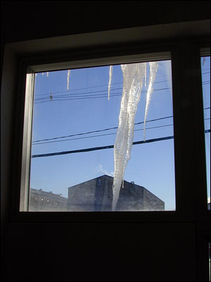
Fernlike crystals of ice grow on window panes. 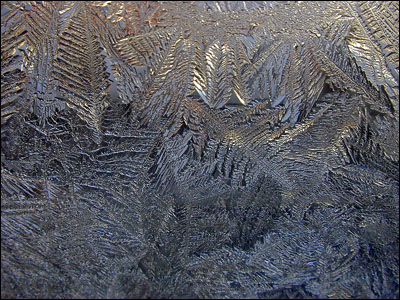
Icicles form on steam exhaust pipes and on buildings. 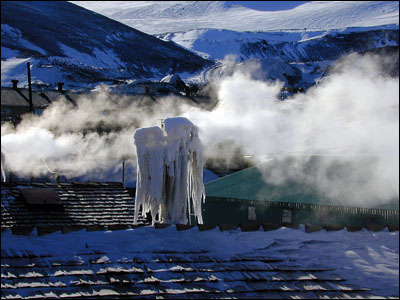
You even get large crisscross patterns that form on the hillsides. 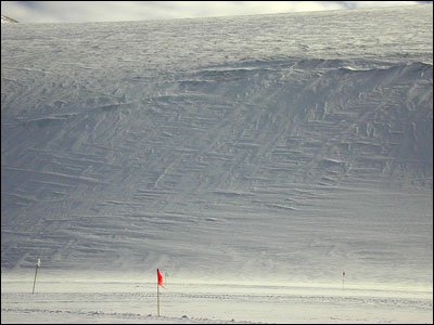
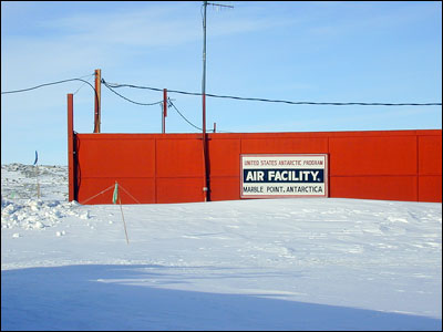
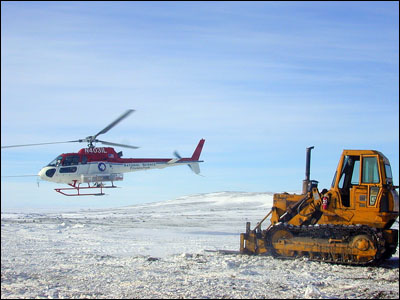
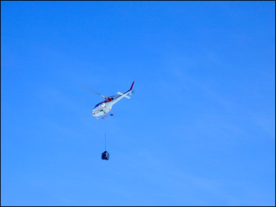
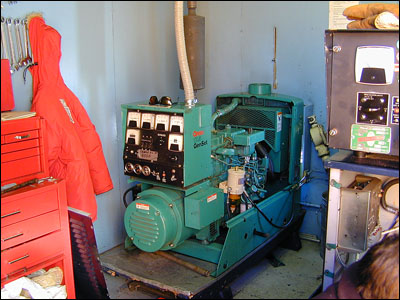
I had a very exciting day this week. My boss and I had to go to Marble Point to replace a 100–amp breaker on the generator set and to check into balancing the load on the generator. Marble Point is across the sound on the mainland. You have to go there by helicopter. We could not have asked for more perfect flying weather. It was a beautiful sunny day with clear skies and rather warm temperatures. I have only been in a helicopter two other times, but it is one of my favorite modes of transportation. It is so much fun, and the views are spectacular. Just flying over McMurdo makes the whole place look differently. 
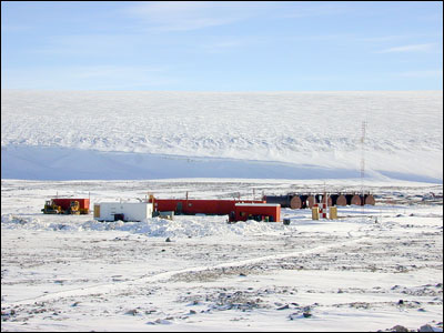
Marble Point is a refueling station. Several large fuel tanks are placed out there so that the helicopters will have a place to get fuel without having to come all the way back to town. Not much else is out there — only six small buildings. You can barely even see the place until you are right up on it. 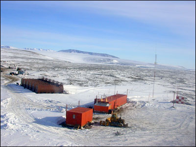
Only two people actually live there — Jeff and Kim. Jeff is the station manager whose job it is to keeps things running. Kim is the cook. 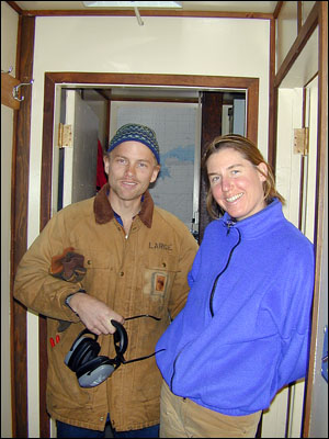
Helicopters will also stop there for food on their travels. It is like a truck stop, only for helicopters. 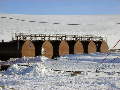
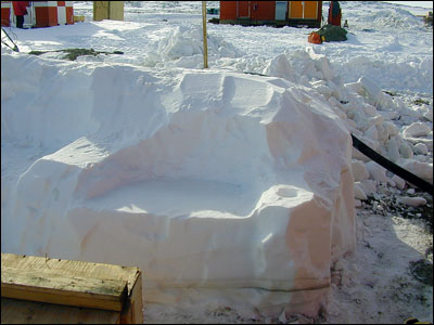
If the weather turns bad there are plenty of places for people to sleep. When we first arrived, Kim had fresh, homemade bread coming out of the oven. For lunch she made us mutton stew that was excellent. Behind their main building they built themselves a patio and barbecue area cut out of the snow. Steps are leading down to the patio and a few chairs cut out of the snow bank. 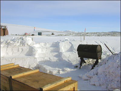
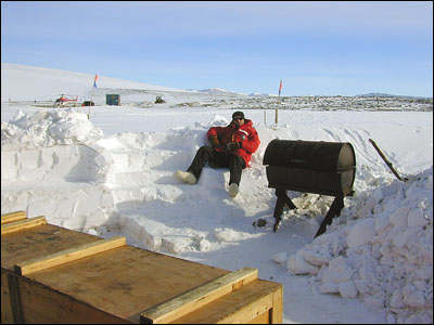
They said they have had many barbecues out there and have really enjoyed it. Especially when the weather was as beautiful as it was the day we were there. We went to work checking out the loads and trying to see why everything was so unbalanced. Then we went into the generator shack and replaced the breaker. 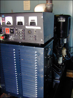
After we finished work I went for a short hike. We did not have too much time. Marble Point is on the coastline and is at the edge of the Wilson Piedmont Glacier. 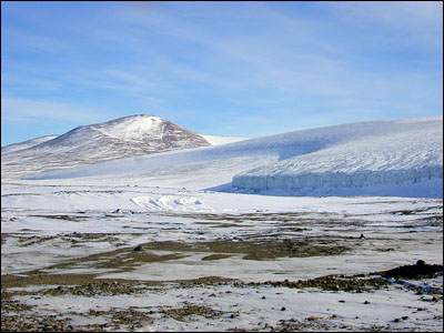
Just off the coastline are several icebergs that have been frozen into the ice. This area is called the Bay of Sails as it is what all the icebergs sort of look like. 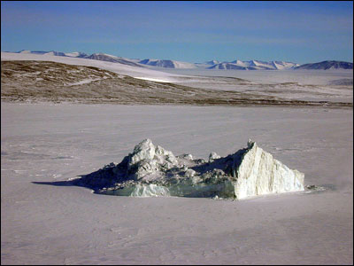
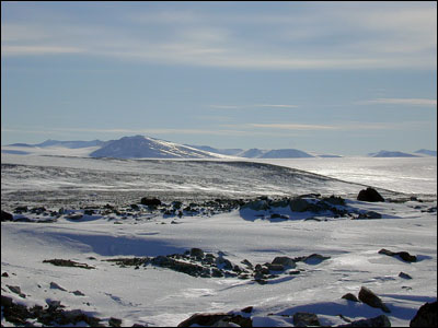
Looking back across the Sound toward Ross Island, Mt. Erebus looked lovely. It seems much bigger when viewed from a distance. It is 12,500 feet high, but has such gently sloping sides that it never appears very tall in any of my photos. 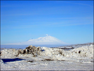
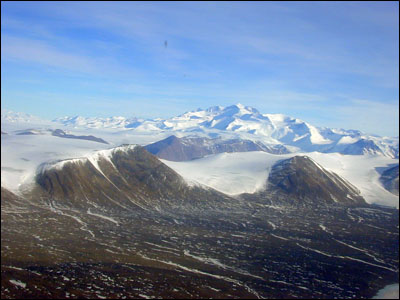
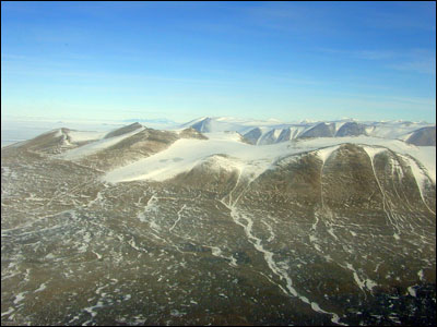
Finally it was time to come home. We packed up the helicopter and headed out. Along the way we passed near the dry valleys and followed the coastline. From that vantage point you can really see the outlines of the dry valleys and the areas that are so totally free of snow. 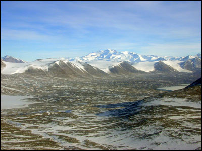
We flew near Lake Fryxell — the camp I got to visit last season. You can see the entire lake from the air. 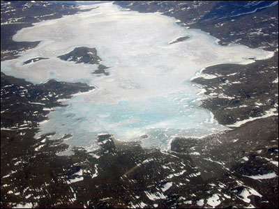
The Commonwealth Glacier near the camp was enormous, but it looks so small from up high. 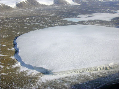
On the far side of Lake Fryxell we could see the Canada Glacier and look all the way up the Taylor Valley. 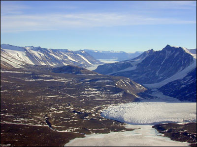
After we passed the dry valleys we flew over the Ferrar Glacier, an enormous glacier coming down from the Polar Plateau. 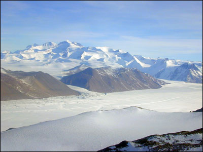
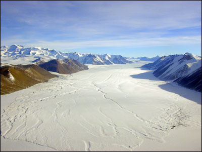
It is amazing to me that you can even see the currents in the glacier, like a river, only frozen. We were flying at 4,000 feet if that helps you get some scale in the photos. The mountains on either side of the glacier range in size from 5,000 feet to 6,500 feet. The mountains in the distance on the left are all at least 11,500 feet with the tallest being 13,200 feet. As we passed over the Bowers Piedmont Glacier heading out over McMurdo Sound, you could see icebergs that had broken off the edge of the glacier and then frozen in again. 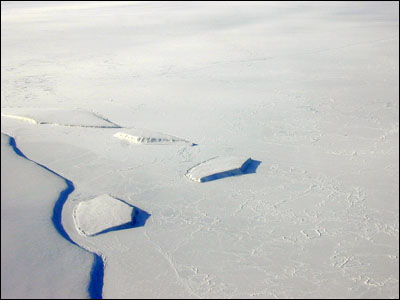
We finally arrived back in McMurdo around 6:00 P.M. It was a very exciting day. I do not know when you will hear from me again as I am leaving soon for Byrd Surface Camp. I have been waiting to leave for a little over a week now, but either the weather here or the weather there has been preventing us from going. Whenever the weather clears we will go, but saying when that will be is hard. Byrd Camp is approximately 900 miles away up on the Polar Plateau in the interior of West Antarctica. It is in an area called Marie Byrd Land. 
I am very excited to be going, but somewhat anxious as well. I am told it is VERY cold and we will be sleeping in tents. For those of you who remember my camping experience last season, I can tell you that it will be at least 30 to 40 degrees colder this time. Last year I only had to survive one night. This time I will be gone at least a week, quite possibly two weeks, and perhaps longer depending on the weather. I hope it will not be longer. They tell me that the tents and sleeping bags they issue us for the deep field are much better than those we had for field safety training class. I certainly hope so. I am still planning to take a few extras of my own. I do not want to speculate too much at this point, so you will have to wait until I return for more details. |
|
| Home Previous Next | |
|
|

|
|
|
|
|
Irma Hale McMurdo Station, Antarctica E-mail: Copyright © Irma Hale. All
Rights Reserved. Free counters provided by Vendio. |
|
|


